

History reveals that Apayao has undergone phases of integration with different cultures.
Spanish missionaries first stepped Apayao in 1608 where they established their foothold at the present day municipality of Pudtol. Among the first missionaries was Father Jeronimo Molina. These early missionaries found the Mandayas (later known as one of the tribes of Isnags) already organized into communities. During the Spanish occupation, the Isnags initiated several petty uprisings. Towards the latter part of the century, the latter part of the century, the Spaniards only claimed to have conquered the lower part of Apayao where they established their politico-militar commandancias. Evidence of Spanish presence are the ruins of churches in barangays Mataguisi and Emilia.

Apayao in 1898 was once part of Cagayan under the military government established by the Americans by virtue of Treaty of Paris with Governor Pablo as their first governor. The natives of Apayao just like other tribes practiced headhunting and other tribal activities threatening the political transactions. Out of fear, government officials of Cagayan abandoned Apayao and even attempted to kill the natives. Looking into the difference in culture, the Provincial Government Act of 1905 separated Apayao from Cagayan with Dean Worchestes as the first officer of Apayao political affairs. The foreign rule was resisted by the natives so the American military government sent Col. Blas Villamor, an Ilocano, negotiated with the Ilocano immigrants and Isnags in Apayao and he was able to win their support. The Philippine Constabulary headquarters was established in Tawit, Flora to serve as they started to live in peace.
The peace situation was contributory to the socio-economic development of the people. With the Isnag’s desire to govern themselves with a governor who understands their language, Col Blas Villamor of the Philippine Constabulary was appointed as the first lieutenant-governor in the area. He proclaimed Tawit in Flora as the official sub-provincial capital. Assembly meetings were instituted. Taxation and infrastructure projects were proposed and implemented. Construction of foot trails and foot bridges linking other settlements were intensified. Official transactions continued in Tawit until July 14, 1914 when it was moved to Kabugao. This was the result of a conference of political leaders who viewed Kabugao as the most strategic location of the seat of political affairs being geographically situated at the center of the sub-province.
When Kabugao was the seat of political affairs, Norman Conner took over Col. Blas Villamor as the governor. Gov. Norman Conner’s leadership led to various socio-economic developments. Later, Kabugao and the neighboring villages were turned into the municipality of Conner in the memory of Governor Norman Conner.
The insurgency problem in the 1980’s resulted in the exodus of barangay folks to the neighboring communities in the lowlands. Rebels infiltrated some parts of Calanasan, Luna, and Flora. This triggered the installation of military detachments to secure the natives from any NPA atrocities. With the infiltration of NPA’s the more Apayao was left behind in terms of delivery of government services.
When the Americans took control over the Philippines, the Cordillera was organized into political territory as the Lepanto-Bontoc province under Act. No. 1876 of the Philippines Commission on August 3, 1908. On February 4, 1920, Act 2772 was promulgated reorganizing the Lepanto-Bontoc province into Mountain Province constituted by five subprovinces of Bontoc, Ifugao, Benguet, Apayao and Kalinga (BIBAK).
After 58 years as a sub-province politically supervised by the provincial governor, the passage of RA 4695 in June 1966 provided that the Mountain Province be divided into four provinces with their respective capitals, Kalinga-Apayao with Tabuk as its capital, Ifugao with Lagawe as its capital, Benguet with La Trinidad while Mountain Province had Bontoc as its capital. The elected officials served the province where they ethnically belonged.
One of the newly created is Flora. Through the efforts of then Honorable Alfredo “Gaygay” Lamen, the municipality of Flora was created out of nine contagious barangays Pudtol situated on the side of the Apayao River. The residents, after crossing through the strong current of the wide and swiftly flowing river, had to hike hours along rugged foot paths to be able to transact business at the town proper. On June 22, 1963, Republic Act No. 3672 was enacted providing for the creation and establishment of the municipality of Flora. The name Flora was in honor of Lamen’s wife, Florence Busacay from Besao, Mountain Province.
On July 15, 1987, Executive Order No. 220 was signed and issued by her Excellency President Corazon C. Aquino created the Cordillera Administrative Region. The province of Kalinga-Apayao and Ifugao of Region 2 and Abra from Region 1 was included in the territorial coverage of the said CAR.
Before the issuance of EO 220, the tribal leaders of Apayao clamored for independence from Kalinga as means for them to frame their own vision aligned with their unique cultural heritage and to give the people the chance to exercise their own management potentials. In February 1987, Mayor Elias K. Bulut of Calanasan initiated the solidarity movement aimed in attaining the separation of Apayao to stand as an autonomous province separate and distinct from Kalinga. Amidst all frustrations, the lobbying in congress was continued by the Apayao Municipal Mayors League with the submission of an autonomy act for enactment.
The Isnags were persistent in their struggle for self governance , Heavily relying on their unique culture as the primary reason for striving for independence from Kalinga. The Isnags believe that the creation of their province will accelerate Apayao’s growth and development because of increased internal revenue allotment (IRA) and other assistance from the national government.
After several years of struggle, Republic Act 7878, authored by Elias K. Bulut was signed by Fidel V. Ramos on February 14, 1995 which provided for the conversion of the sub-provinces of Kalinga and Apayao into regular provinces to be known as the province of Kalinga and Apayao, amending Republic Act No. 4695. Congressman Elias K. Bulut was joined by Kalinga Governor Lawrence B. Wacnang who led a delegation of local leaders in witnessing the historic event.
The first set of local officials of the province of Apayao who took their oath on August 1, 1995 was Hon. Batara P. Laoat as the Governor, Hon. Hoyt Lacuesta as Vice Governor. The Sangguniang Panlalawigan members were Donato balag, Manuel Betat, Bernardo Gerde, Rodolfo Juan, Orlando batugal, Nicolo Ganac, James Gullayan and Scott Socbot.
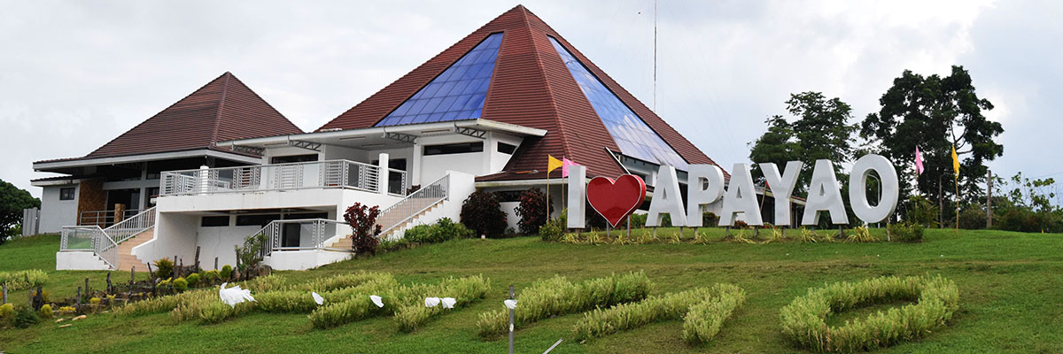
The province of Apayao is composed of seven municipalities of Calanasan, Conner, and Kabugao in upper Apayao; Flora, Pudtol, Luna and Sta. Marcela in lower Apayao. Kabugao is the capital town. Apayao lies in the northernmost section of the Cordillera Region. It is located as the “bust-like” portion in a “seated-man” map of Cordillera. It is bounded by the province of Kalinga in the south, Ilocos Norte in the west and Cagayan in the east. Portions of Ilocos Norte and Cagayan line Apayao’s northern side. Its total land area is 392,790 hectares which 21% of the total land area of Cordillera Administrative Region. Calanasan has the biggest land area of 140,298 hectares and Sta. Marcela ha the least land area of 70.90 hectares.
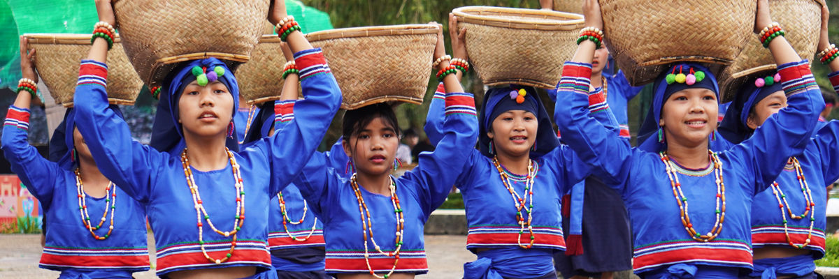
The Apayaos and the Isnags inhabit the northern part of the province with their seat of culture established in Calanasan, Kabugao and Conner. Apayao terrain is generally characterized by mountains, valleys and foothills which mark the area of ideal sanctuary for rich hardwood, rainforests and savanna grasses. The area is also rich in mineral resources. It has mountains with elevations as high as 1700 feet above sea level.

Apayao is describe by Mike Guimbatan (Skyland News February 8, 2004) as the land of the Isnag tribe, the newest province on the Cordillera region, and it is located at the topmost portion of the regional map with 78,454 registered voters,
As Guimbatan said, Apayao is still Bulut country. Elias Bulut sr., had been a long time mayor of Calanasanan in the early 1990s he won as congressman of Kalinga Apayao. Congressman Bulut managed to separate Kalinga and Apayao as two independent provinces and in 1995 he designated the first set of provincial leaders. In 1998 elections, Elias Bulut Sr. remained as the congressman. In 2001 elections, Elias Bulut Sr. won as the governor of Apayao; Elias Bulut Jr. as congressman; and his sister Leah Bulut Begtang run unopposed and became mayor of Calanasan until today.
Through the Buluts’ leadership, development poured all over Apayao that contributed to the Isnags’ peaceful situation. The province is a fourth class province. Locally taxable sources of income are still largely untapped.